T(r)ips
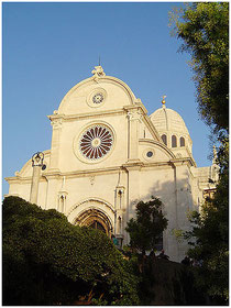
Šibenik
Entlang dem überschwemmten Ufer des Flusses Krka liegend, ist die malerischste Stadt an der adriatischen Ostküste. Zum ersten Mal im Jahre 1066., während der Herrschaft von König Kresimir IV. Erwähnt, erweiterte sich die Stadt amphitheatermäßig unterhalb der Klippe, auf welcher die Festung des hl. Michael dominiert. Von dort führt das Geflecht steiler Gassen und überwölbter Durchgänge, wo sich der geschichtliche Stadtkern mit dem Stadtkranz, dem Fürstenpalast und der berühmten Kathedrale des hl. Jakob befindet. Zusätzlich zu dem hl. Michael, zeugen noch zwei nahe liegende Festungen über die turbulente Vergangenheit der Stadt.
Located alongside the flooded mouth of the Krka River, is the most pitoresque city on the eastern Adriatic coast. It was first mentioned in 1066., during the reign of the Croatian King Kresimir IV, when the city began to spread like an amphitheater below the cliff dominated by the fortress of St. Michael. The complex of streets and arched passages leading toward the harbour evolved from this, enclosing the nucleus of the city with the town hall, the princely palace, and the famous Cathedral of St. James. In addition to St. Michael, another two nearby fortresses bear witness to the turbulent past of the town.
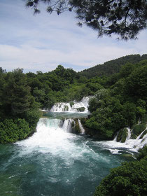
Der Nationalpark Krka ist ein natürliches Phänomen des dalmatinischen Karsts. Der Fluss Krka kreiert bei seinem Verlauf in Richtung Meer sieben tosende, malerische Wasserfälle, unter welchen am berühmtesten Roski slap und Skradinski buk, die höchsten Rauhwackenbarrieren Europas, sind.
The National park Krka is a natural phenomenon of the Dalmatian karst region. In its course towards the sea, the Krka River created seven noisy, picturesque waterfalls, the best known being Roski Slap, and Skradinski Buk, the tallest travertine barriers in Europe.
Kornati
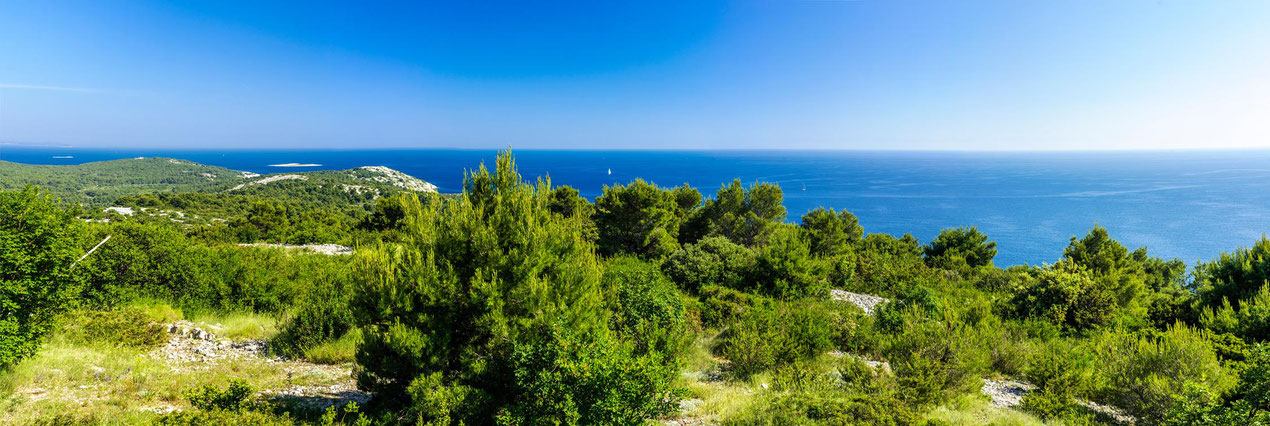
In the central part of croatian Adriatic Sea, about 15 Nm to the west from Sibenik town, 7 Nm to the southwest from Murter, or 15 Nm to the south from Zadar town, there is amazing group of
islands named Kornati archipelago.
Beauty and singularity of the archipelago moved authorities in 1980 to proclaim a bigger part of that area national park. Since then certain modifications of its borders were made, so that
nowadays Kornati National Park occupies the area of about 220 km2 (54.000 acres). There are 89 islands, islets and reefs within the area of Kornati National Park (238 km of the coastline), what
makes it the most indented group of islands in the Mediterranean.
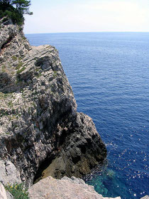
The land part of Kornati National Park covers less than 1/4 of its total area, but the values of its landscapes, the "crowns" (cliffs) on the islands facing the open sea, and interesting relief
structures, make this part of Kornati National Park unique. Besides, the Kornati submarine area, whose biocenosis are considered to be the richest in the Adriatic Sea, and also the magnificent
geomorphology of the sea bed attracts divers from all over Europe to come and enjoy in unforgettable submarine adventures.